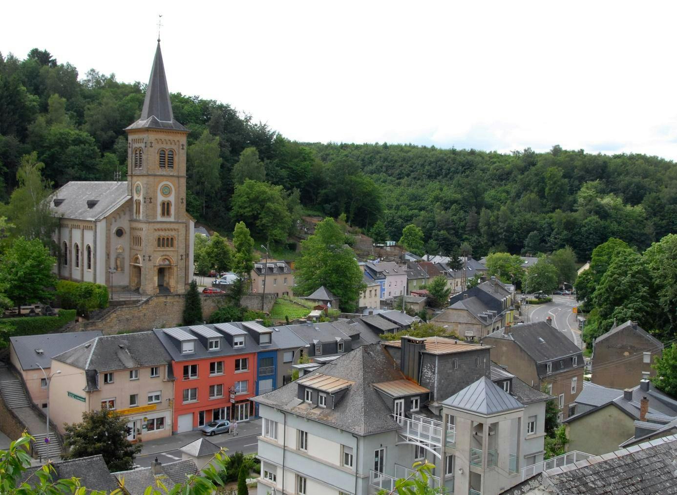
Rollingergrund, Belair-Nord: spacious green neighborhood in Luxembourg
In this article, we will weigh the pros and cons of residing in Rollingergrund / Belair-Nord, dissect the area's transport accessibility, take a closer look at its infrastructure and more.
The Rollingergrund / Belair-Nord neighborhood is nestled at the northwest border of the capital, Luxembourg. Bounded by Mühlenbach, Limpertsberg, Ville-Haute to the east, and Belair to the south, it spans from the northwest of Ville-Haute to the extreme northwest of the city, largely incorporating the former commune of Rollingergrund.
General characteristics of Rollingergrund / Belair-Nord
While the neighborhood encompasses extensive woodlands, the inhabited zone lies in the southern part within the valley along the main street, Rue de Rollingergrund. Lacking a distinct center, the area is predominantly residential, hosting numerous single-family homes. The architectural landscape is diverse, with structures dating back to the 18th century, alongside those from the mid-20th century when the region experienced robust development.
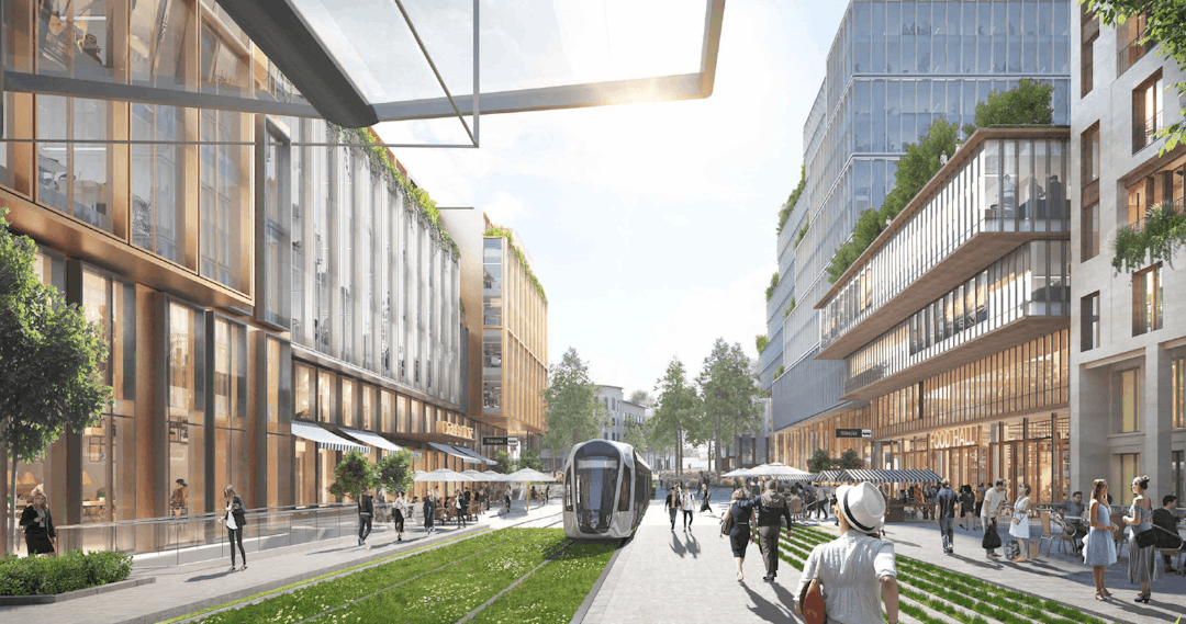
Towards the southern end, particularly along Route d’Arlon, commercial and service establishments thrive, featuring prominent institutions like the Centre Hospitalier de Luxembourg and Stade Josy Barthel. Noteworthy is an ongoing mobility project poised to transform Place de l'Etoile into a vibrant pedestrian space, complemented by a tramline and a variety of shops.
Population of Rollingergrund / Belair-Nord neighborhood
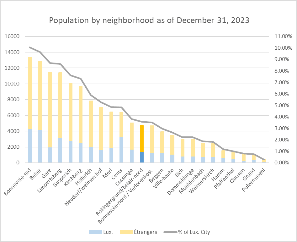
As of January 1, 2024, the population of Rollingergrund / Belair-Nord stood at 4,724 individuals, constituting 3.56% of the capital. Despite being the second-largest neighborhood spanning 633.87 hectares, the majority of residents are concentrated in the southern region. Positioned midway on the population spectrum, Rollingergrund / Belair-Nord boasts a foreign resident percentage of 70.49%, closely aligning with the capital's average of 70.44%.
Transport accessibility


You can check the route of each bus line in detail on the interactive map provided by the city of Luxembourg and get detailed instructions to get from one point to another on their route planner page.
Future of l'Etoile
The ongoing urban project on Place de l'Etoile is worth mentioning, one of the capital's key intersections and gateways. With the completion of the new "Place de l'Étoile" project, the square will retain its role as a transportation hub and become a major traffic artery connecting the western neighboring municipalities. This will be facilitated by improved connections to existing public transportation and the tram network extension from Place de l'Étoile to the municipality of Strassen. Envisioned to promote sustainable mobility, this new axis will feature bike lanes, vel'OH! rental stations, and pedestrian links, particularly benefiting Rollingergrund.
Renting and buying real estate
Rollingergrund / Belair-Nord offers an attractive real estate market with buying prices noticeably below the city's average, around nine thousand six hundred seventy-one euros per square meter compared to the capital's average of twelve thousand eighty-nine euros per square meter.
While rental prices are not as advantageous, they are still fair at about thirty euros and sixty cents per square meter, closely matching the city's average of thirty euros and fifty-three cents per square meter.
For purchase prices stand at
For renting prices stand at
Applications, search and profound advice in our guide to rent in Luxembourg

Infrastructure of the neighborhood
Rollingergrund / Belair-Nord, primarily a residential enclave, surprises with its diverse infrastructure catering to the needs of its residents. Amidst the leafy streets, you'll find the Centre Hospitalier de Luxembourg and educational hubs like the Lycée Technique pour Professions de Santé. Sporting enthusiasts can enjoy facilities around the iconic Josy Barthel Stadium.
One focal point is the ongoing project at Place de l'Etoile, Although the improvement of the mobility conditions of users is one of the essential guidelines of the project as previously mentioned, it is not the only guideline of the project.
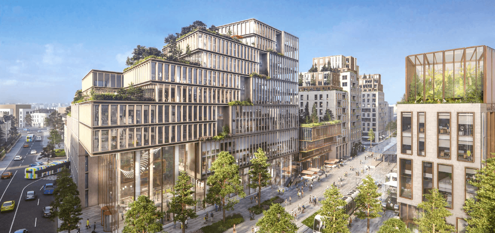
Aligning with the city's emphasis on housing creation. Covering 102,745 m², this venture prioritizes residential spaces, dedicating 47% of the area to construct over 600 homes, including affordable housing options. A dedicated 8% of the space integrates commercial areas, a fitness center, a food hall with terraces, and a five-screen multiplex cinema. The project also allocates 45% of the area for office spaces, reflecting a balanced approach to meet various community needs
Place to call home
If you're considering making Luxembourg your new home, we encourage you to explore our range of articles that look in depth at the different city communes and neighborhoods.
Pros and cons of living in the Rollingergrund / Bellair-Nord neighborhood
Rollingergrund stands out for its prime location, offering proximity to the capital and the vibrant Limpertsberg district, a hub for cultural, sports, commercial, and educational establishments, including a notable University of Luxembourg campus. The neighborhood boasts the Centre Hospitalier de Luxembourg, enhancing its appeal. Abundant green spaces and proximity to Bambësch forest make Rollingergrund particularly attractive for families.
What can you find in this neighborhood of Luxembourg City
Rollingergrund / Belair-Nord is not just a residential neighborhood; it's a dynamic community with a thoughtful blend of essential services, recreational spots, and upcoming projects to enhance its infrastructural landscape.

In Rollingergrund, educational opportunities abound, with a public primary school and a public childcare center catering to the young ones. Additionally, several private nurseries contribute to the comprehensive early education landscape, including those affiliated with the Barbara and Rockids networks, as well as Frimousses daycare.
Notably, the Lycée Technique pour Professions de Santé, a healthcare-focused educational institution, enriches the academic milieu. Offering training in various health domains such as pharmacy assistance, radiology, nursing, and midwifery, it conveniently sits adjacent to the Centre Hospitalier de Luxembourg. With over 1,300 students across its three campuses, Bascharage, Ettelbruck, and Rollingergrund, the institution plays a pivotal role in health education.
While universities aren't within the neighborhood, residents benefit from the proximity of a University of Luxembourg campus in the neighboring district of Limpertsberg, further expanding educational opportunities for those in Rollingergrund / Belair-Nord.
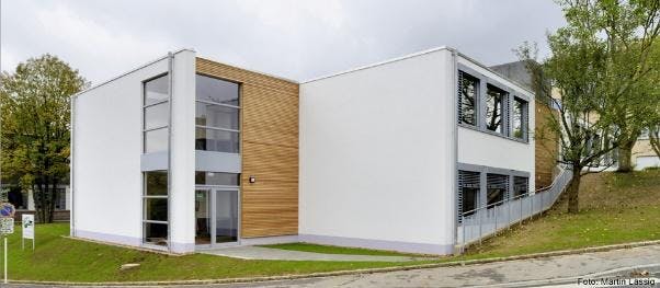
Rollingergrund Primary School
Rollingergrund childcare center
Lycée Technique pour Professions de Santé
Barbara Nursery Rollingergrund
Rockids Rollingergrund Nursery
Frimousses Nursery
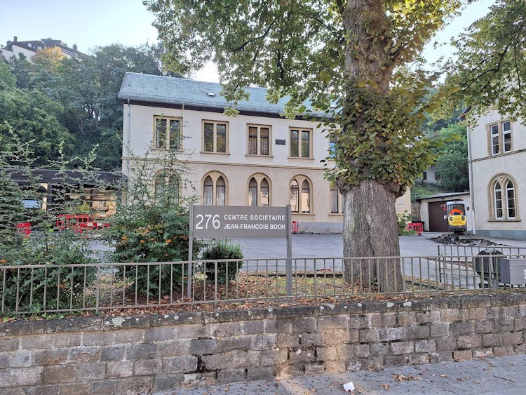
Rollingergrund's cultural offerings are modest, centered around the notable Rollingergrund Cultural Center Jean-François Boch. This public events space hosts various activities regularly. However, for a more expansive array of cultural events and facilities, residents often venture to neighboring districts, where a broader cultural scene awaits.
Rollingergrund Cultural Center Jean-François Boch
Learn more about Luxembourg's culture and traditions in our special guide.
Rollingergrund is fortunate to host the primary healthcare facility of the capital, the Centre Hospitalier de Luxembourg (CHL). The CHL comprises four major centers, with three located in Rollingergrund: CHL Centre, CHL Maternity, and CHL KannerKlinik. As a public hospital, the Centre Hospitalier de Luxembourg offers an extensive range of medical services and specialties, ensuring residents in the neighborhood and the city at large have access to top-tier healthcare facilities and expert medical care within easy reach.
Clinique Zitha
Kirchberg Hospital
Centre Hospitalier de Luxembourg
CHL Eich
You can read more about urgent healthcare in our dedicated article: Emergency medical help in Luxembourg: ambulance and hospitals.
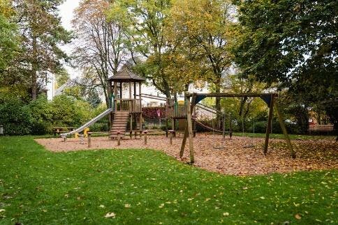
Rollingergrund / Belair-Nord embraces a family-friendly environment with several well-distributed playgrounds throughout the neighborhood. Play areas are found in Rue du Charly, near Place de l’Etoile, Rue Val Fleuri, close to the primary school, within the school premises, near the Rockids daycare on Rue de Rollingergrund, and in Sieweburen, north of the neighborhood, just before entering the Bambësch forest.
- Playground Charly: Rue du Charly
- Playground Val Fleuri: 17-23 Val Fleuri
- Primary School Playground: 239 Rue de Rollingergrund
- Playground Rue de Rollingergrund: Rue de Rollingergrund
- Siewebueren Playground: 36 Rue des Sept-Fontaines
Close by, technically in the neighboring Limpertsberg district but within a 5-minute walk from the primary school, is the expansive Tony Neuman Park. Hidden behind the stately home once owned by Tony Neuman on Nicolas Ries Street, this park boasts towering sequoias, vibrant flowers, and a romantic flower-covered archway. Additionally, the park showcases numerous sculptures created by renowned Luxembourgish artists.
For nature enthusiasts, Rollingergrund offers a network of walking trails, providing easy access to the picturesque Bambësch forest in the northern part of the neighborhood. These green spaces and recreational areas contribute to the neighborhood's charm, providing residents with ample opportunities for outdoor activities and leisure.
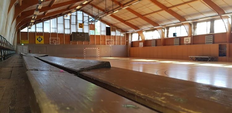
Rollingergrund boasts numerous sports facilities, many clustered around the Josy Barthel Stadium. Adjacent to the stadium, tennis courts are serving as the headquarters for the Tennis Club Stade, offering various tennis courses. Close by, a multipurpose sports hall provides additional opportunities for diverse athletic activities. Although the Josy Barthel Stadium, once the national stadium, is located in the neighborhood, it has been replaced by a newer, more modern facility. It is planned to demolish the current stadium and use the land for housing.
Beyond the stadium vicinity, the neighborhood features a gymnastics hall within the primary school premises. However, access to this facility is restricted to official schools and clubs in the city.
Primarily residential, Rollingergrund / Belair-Nord features a limited but varied range of shops and restaurants. Notable establishments include the Moroccan restaurant Le Royaume on Rue de Rollingergrund and La Feluca near the stadium. For organic shopping, Naturata, located at 161 Rue de Rollingergrund, stands out as a go-to store within the neighborhood.
Historical overview
Rollingergrund's evolution was profoundly shaped by the Faiencerie, a porcelain factory founded in 1766 by the Boch brothers, Jean-François, Dominique, and Pierre-Joseph. Operating under the name Villeroy & Boch until 2010, this factory left an indelible mark on the neighborhood's identity.
Seven fountains
Joining the City
Frequently Asked Questions (FAQ)
Are there ongoing and upcoming infrastructure projects in the area?
Certainly, the ongoing project at Place de l'Etoile is a pivotal initiative aligning with mobility improvements and housing creation. Covering 102,745 m², it prioritizes residential spaces, dedicating 47% to construct over 600 homes, emphasizing affordability. Additionally, 8% integrates commercial spaces, fitness centers, a food hall, and a five-screen multiplex cinema. With 45% allocated for office spaces, this project reflects a comprehensive approach to enhance Rollingergrund / Belair-Nord's overall infrastructure and community well-being.
What are the pros and cons of living in Rollingergrund / Belair-Nord?
Pros include its prime location near Limpertsberg, diverse cultural offerings, and the presence of Centre Hospitalier de Luxembourg. On the flip side, residents may contend with traffic congestion, particularly along Rue de Rollingergrund.
What are the healthcare facilities in Rollingergrund / Belair-Nord?
Rollingergrund is home to Centre Hospitalier de Luxembourg (CHL), featuring major centers like CHL Centre, CHL Maternity, and CHL KannerKlinik. This public hospital ensures residents have access to top-tier healthcare services.
What are the real estate prices like in Rollingergrund / Belair-Nord?
Real estate in Rollingergrund / Belair-Nord offers affordability, with purchase prices notably lower than the city average. Rental rates, while reasonable, align closely with the city's average, providing a cost-effective housing solution.
What sports infrastructure does Rollingergrund / Belair-Nord offer?
The neighborhood boasts diverse sports facilities, including tennis courts near Josy Barthel Stadium, hosting the Tennis Club Stade. Multipurpose sports halls and walking trails complement these offerings, contributing to an active and healthy lifestyle in Rollingergrund / Belair-Nord.
Source: www.vdl.lu, fr.wikipedia.org, www.justarrived.lu, www.vdl.lu, lequotidien.lu, fr.wikipedia.org, www.immotop.lu
We took photos from these sources: Ville de Luxembourg, Lycée Technique pour Professions de Santé, Barbara Nursery Website, Rockids website, Rockids website, Spillplaz, Wikipedia, Google Maps