AIRMO detects methane leaks from the air. Its own satellite is next
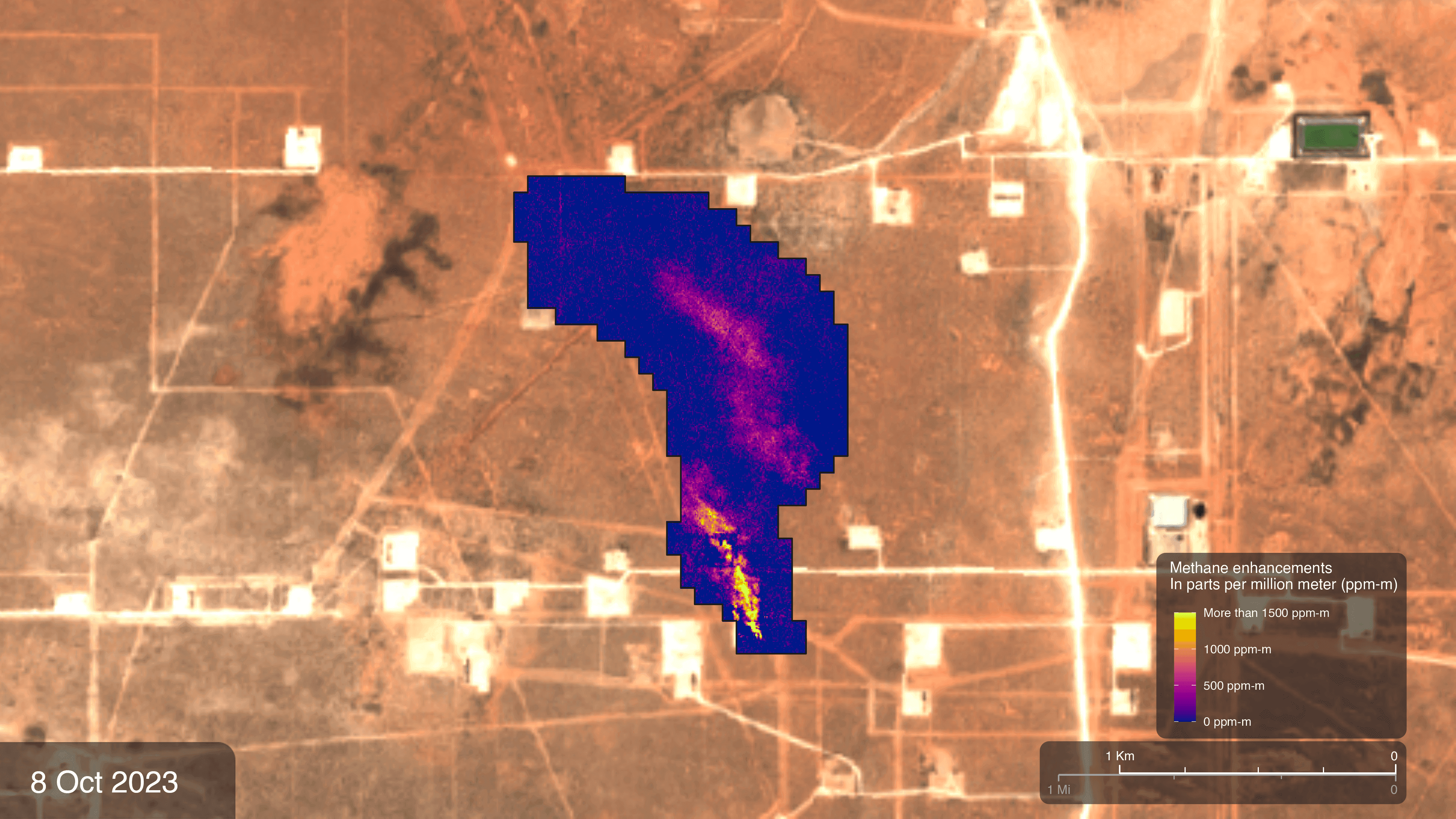
Иллюстрация: Zoey N. Armstrong и Helen-Nicole Kostis / NASA Scientific Visualization Studio. https://svs.gsfc.nasa.gov/5389/ . Изображение NASA; не показывает проект AIRMO.
Luxembourg-based AIRMO is already detecting methane emissions from the air: its devices are mounted on drones and aeroplanes, and the data collected helps to identify which sites require inspection. The next stage is the company’s own satellite, which it is developing in partnership with the Bulgarian firm EnduroSat. According to a Luxinnovation report dated 5 November, the launch is scheduled for the final quarter of 2027.
Methane can escape from pipelines, equipment and other industrial facilities. When the source is unknown, it is difficult for the operator to determine where to look for the leak. AIRMO offers remote measurement of emissions and an assessment of their scale, enabling inspections to be targeted at specific sites. The company already provides such services using aerial surveys and processes data from third-party satellites.
AIRMO is developing two complementary instruments for its own satellite. The short-wave infrared spectrometer is designed to detect the characteristic signature of methane in reflected light; the compact LiDAR instrument is intended to refine the measurements. The developers hope to observe individual industrial sites from space, but the stated performance characteristics have yet to be confirmed during in-orbit operations.
At the end of August, the company used a high-altitude aircraft to carry equipment similar to the future satellite payload. This is an important test of the equipment, but it is not a satellite launch, nor does it prove that the system will be just as accurate from space. Until the launch, AIRMO will continue to use aerial measurements and available satellite data from other operators.
For Luxembourg, the project demonstrates how the local space and climate sector can transition from research equipment to providing a service for industrial clients. The practical value of existing measurements lies in the ability to identify a site for ground-based testing more quickly. Global observation using its own satellite remains the next step rather than an operational service.